Description
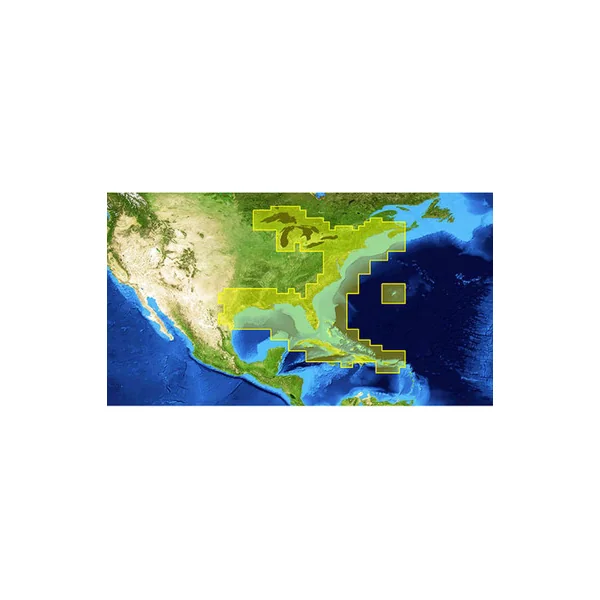
Lowrance 000-12218-001 Nautic Insight HD East v15 Marine Charts offer advanced detail Eastern U.S. coastal and offshore sea maps for fishing, cruising, and sailing, with high-definition shaded relief that provides enhanced views of underwater structures.
Lowrance 000-12218-001 Nautic Insight HD East v15 Key Features:
- Aerial imagery with the option to download even higher detailed imagery from Insight Genesis at no additional charge
- Updated NOAA ENCs and Marine Protected Areas
- Improved Bathymetric Contour Detail with greater coverage and more accurate detail to navigate more safely and identify key fishing areas
- Updated Maptech and Fishing Hot Spots Points-of-Interest with more than 200,000+ points-of-interest
- 20 more levels of high-definition, shaded-relief imagery beyond standard Insight USA charts – for an easier-to-understand view of the sea floor at all zoom levels
- Compatible with all Lowrance HDS, Mark/Elite-HDI, Mark/Elite Chirp fishfinder/chartplotter devices
Reviews
There are no reviews yet.